Exploring the Significance of Weather Maps
The Importance of Weather Maps
Weather maps are essential tools used by meteorologists and enthusiasts alike to understand and predict atmospheric conditions. As climate change continues to impact weather patterns globally, the relevance of accurate weather maps becomes increasingly significant for agriculture, disaster preparedness, and daily life.
What Are Weather Maps?
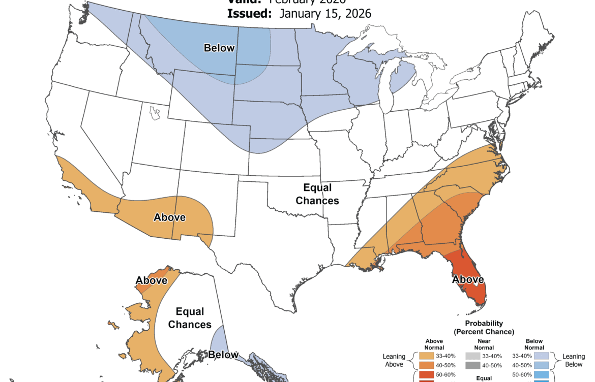
Weather maps visually represent meteorological conditions across specific areas at a given time. They display crucial elements such as temperature, precipitation, wind speed and direction, and atmospheric pressure. Various types of weather maps exist, including surface maps, upper-level maps, and precipitation maps, providing different insights into weather patterns.
Types of Weather Maps
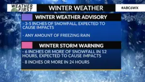
1. Surface Weather Maps: These maps depict weather conditions at ground level, offering insights into temperature, humidity, and atmospheric pressure. They often include isobars, which connect points of equal pressure and can indicate wind patterns.
2. Satellite Imagery: Advanced technology allows meteorologists to monitor cloud cover, storms, and other weather phenomena from space. Satellite imagery is crucial for tracking severe weather events.
3. Radar Maps: Radar technology enables the detection of precipitation in real-time. These maps are vital during storm events, allowing meteorologists to predict severe weather such as tornadoes or hurricanes with better accuracy.
Current Events and Weather Trends
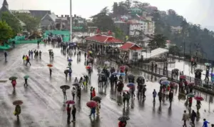
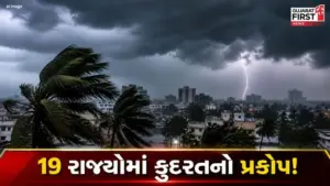
As of October 2023, the use of weather maps has garnered increasing attention due to extreme weather events globally, such as hurricanes, wildfires, and unprecedented rainfall. Recent innovations in predictive modeling and digital platforms have enhanced the accessibility and accuracy of weather maps. This enables not only professional meteorologists but also the public to make informed decisions regarding potential weather disruptions.
Conclusion
The significance of weather maps transcends basic forecasting; they play a critical role in preparedness and safety. As technology advances, the accuracy of weather maps will improve, offering better insights into climate change’s impact on local and global scales. Staying informed through reliable weather maps will be essential for individuals and communities in mitigating risks associated with extreme weather events.